Mapping Aerial Photographs
An important task is to transfer the archaeological information visible on the vertical and oblique photographs to composite maps that are sufficiently accurate and readable for other archaeologists to use. The mapping of the archaeological landscape enables archaeologists to choose their special area of interest for a closer investigation in the form of excavations or other, more costly prospection methods (e.g. geophysical prospecting).
The process of detailed mapping is best explained using the example of a landscape project. The research area is situated 30 km southeast of Vienna, covering a 10 km wide corridor along the valley of the river Leitha and the adjacent area of the Leitha mountain range. Altogether, the research area has a size of about 600 km2. In the course of the research (2003-2005), a detailed archaeological map of the total area was produced.
Between 2003 and 2005 several reconnaissance flights (altogether 35 hours) had been carried out. Through a contract with an Austrian military air base we have free access to all of their vertical photographs made using a Zeiss RMK with a format of 23 by 23 cm. Their scales range between 1: 30.000 and 1: 5.000, but a scale of about 1: 8.000 is preferred and mostly available. More than 2.000 vertical aerial photographs, made by the Austrian air force in Langenlebarn, were archaeologically interpreted.
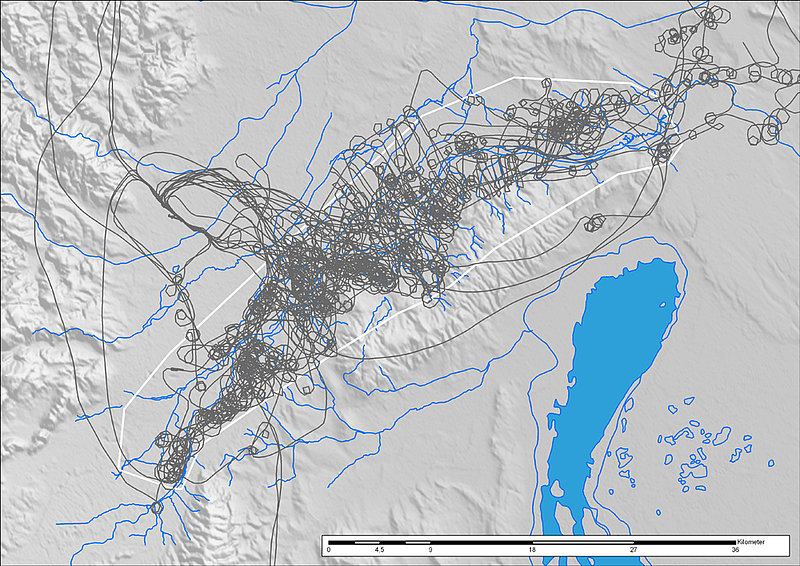
GPS-recorded flightpaths of 35 hours reconnaissance
If not made digitally, the aerial photographs are scanned using the Vexcel Ultra Scan 5000. Using its automatic roll film unit, a film is scanned automatically at high resolution. All of the aerial photographs and sites were input into our GIS based archive (ArcView 3.3); this integrates our Aerial Archive, the sites record, the digital image database, and the interpretations.
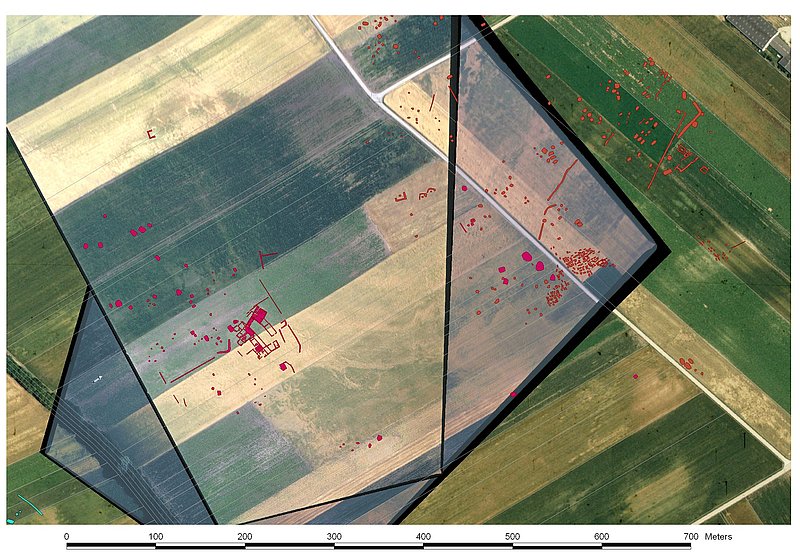
Before a detailed interpretation of the archaeological features could take place, all of the relevant aerial photographs (over 400) had to be rectified. First a recent vertical coverage of the area was oriented using aerotriangulation and rectified using the Leica Photogrammetry Suite (LPS). The resulting orthophotographs were then used to provide secondary ground control information for the rectification of further vertical, and the oblique, aerial photographs.
LPS was also used to rectify the other relevant vertical aerial photographs. Ground control was obtained from the already rectified orthophotographs and the DTM. While the rectification of vertical aerial photographs usually should not cause too many problems, mapping from oblique photographs can be a more difficult task. Problems are mainly due to perspective distortions, that are the result of the oblique viewing angle and the topography of the site, use of non-calibrated cameras, lack of well distributed ground control information, and an often missing stereo partner. At least two specialist programs have been written for aerial archaeologists to overcome some of these difficulties: Aerial and AirPhoto. Using photogrammetric principles, both of them provide the archaeologist with the possibility to rectify single oblique photographs. In the project, we were mainly using Scollar’s AirPhoto (http://www.uni-koeln.de/~al001/airphoto.html). It is easy to use and allows the oblique photographs to be mapped directly on the orthophotographs of the previously rectified verticals. Since most of the sites were located on reasonably flat terrain, most of the oblique aerial photographs could be rectified with errors smaller than +/- 1,5 m.

Rectified vertical photographs in GIS-environment
Rectified oblique photographs
Altogether, more than 400 aerial photographs were rectified and consequently interpreted in GIS. The interpretation was done image by image on screen in separate layers using different colours and attributes for different features. During the process of drawing the interpretation, descriptive values are added in the corresponding database(s). In the attached attribute table, for each drawn feature the information on its description, function, and context, the number of the interpreted photograph, and the interpreter were input.
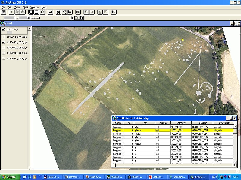
GIS-based mapping